
Follow a Toms River Street Address
Work from the ground up. A Toms River street search is strongest when each step keeps the parcel identity attached to the name or record being checked. The Toms River GIS viewer supplies the first crosswalk from a property location to its block, lot, parcel attributes and tax-map link. The assessor and county tax list then add the ownership and tax-record layer. The County Clerk index adds dated instruments. Voter material and older directories are narrower forms of evidence, so neither should be treated as a complete list of everyone at an address. A record may say Toms River Township, Toms River CDP, or a Toms River postal label, so retain the wording tied to each Toms River result.
- Enter the street address in Toms River GIS, or search by Block & Lot. Zoom to the parcel, click it, and record the displayed attributes, block, lot, parcel ID and tax-map link.
- Use the block and lot in the Ocean County tax-list search or ask the Toms River assessor for the property-record-card context. Keep the situs address apart from the owner mailing address.
- Run the owner, lot and block, parcel fields, or legal-description terms in the County Clerk's SearchNG index. Save the instrument number, date, party role, book or page, and linked-record details.
- For voter evidence, use the state registration-status route or request a lawful record from the Ocean County Election Board. The research did not verify a public street-wide voter browser.
- For older occupancy clues at a Toms River address, ask Ocean County Library or the Ocean County Historical Society for phone, city, reverse, or criss-cross directories, then compare adjacent editions.
That chain moves from an exact location to ownership, a deed trail, limited registration evidence, and historic address evidence. It is more dependable than assuming that one current property field describes an entire Toms River household.
Toms River GIS Along a Street
The Toms River GIS viewer accepts a property location or an existing block and lot. For a whole named street, pan along the Toms River segment instead of relying on a ZIP guess. Click each Toms River parcel that matters and note its attributes before moving to the next one. The viewer provides zoom, zoom-out and pan controls, and a feature click can return attributes plus a tax-map download link. Some map layers need to be turned on and may appear only at full extent or a close zoom.
The Toms River GIS landing page shows the address and block-and-lot routes that begin a Toms River street directory search.
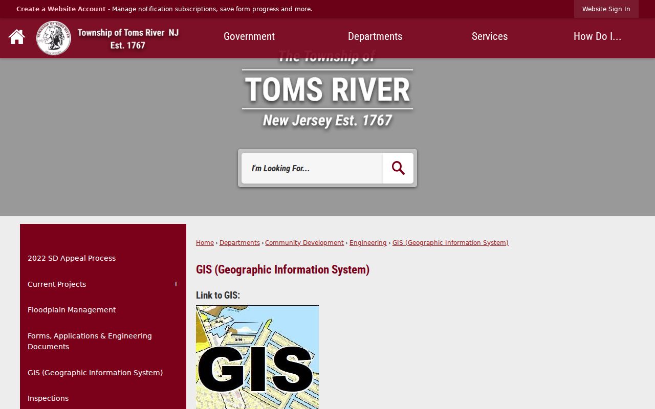
Use the Toms River map to identify and inventory a parcel, not to create a legal description or survey boundary. The township warns that GIS data may not be accurate, so the map should be checked against the tax record and recorded document when the result matters.
Ocean County's GIS hub adds parcel and ModIV data, zoning, flood, easement, road and planning layers. Those layers help separate Toms River parcels that share a street name or sit near a municipal edge. They do not turn a parcel map into proof of present occupants.
Note: Toms River map layers are useful locator tools, but the township expressly says the viewer cannot supply a legal description.
Read the Toms River Tax List
The Toms River assessor maintains descriptive property-record-card information, ownership records, tax maps, deductions, exemptions and qualified-farmland information. Its office page is a service source, not a verified public owner-name form. The inspectable county alternative is parcel-led. Start with the Toms River street location or with the block and lot obtained from GIS, then use the county tax form and the Toms River assessor office to confirm the property record. The form did not expose a historic start year or a complete set of property-class choices.
The Ocean County tax-list search displays the parcel and location controls used to narrow a Toms River address.
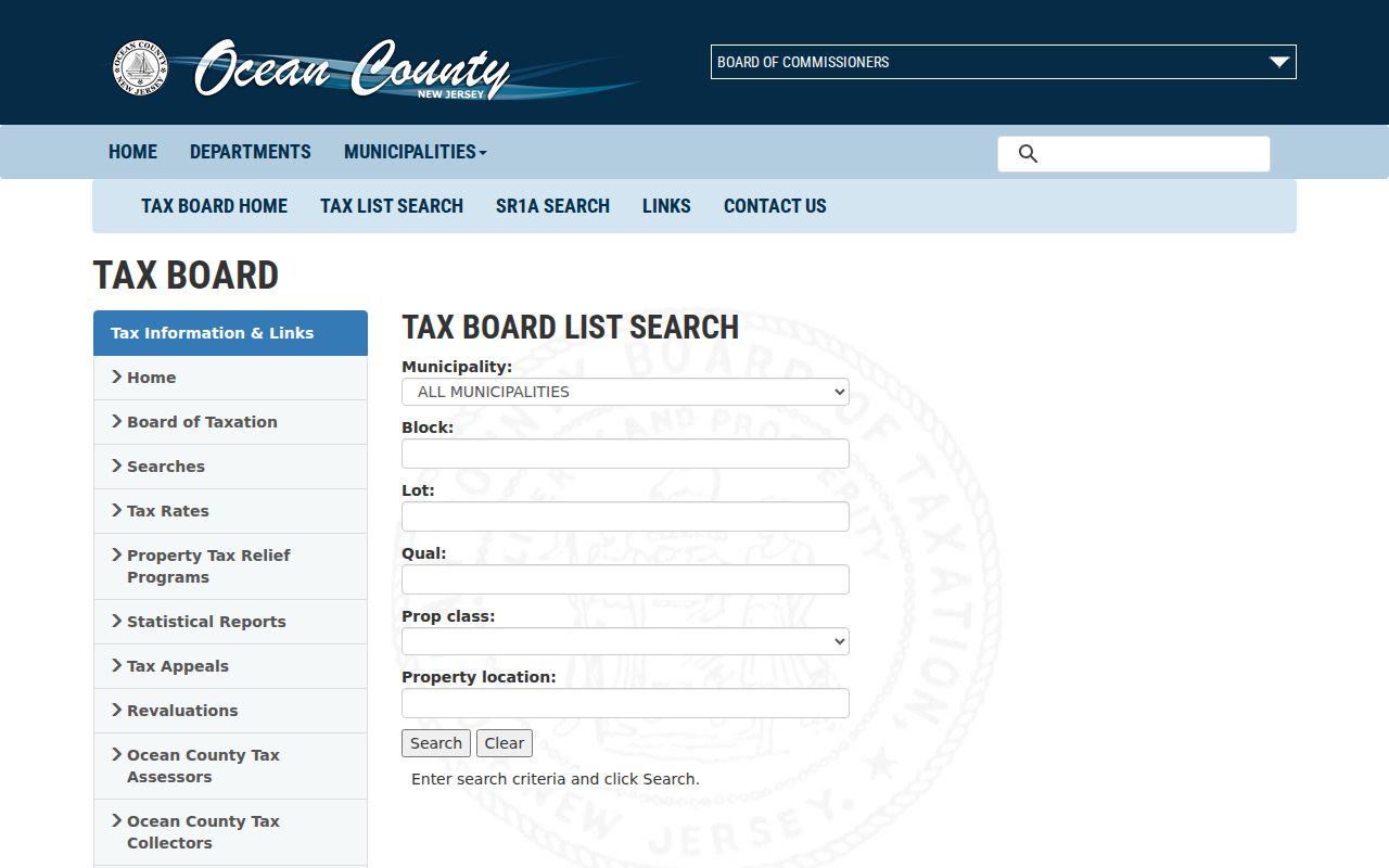
The screen supports a careful Toms River parcel crosswalk. A Toms River location can locate a likely lot, while block, lot and qualification keep the Toms River tax result tied to the correct property when names or postal labels vary.
| Tax-list field | Control | How it helps a street search |
|---|---|---|
| Municipality | Dropdown | Select Toms River before comparing a block or property location. |
| Block and lot | Text fields | Use the tax-map identity copied from GIS; pair the two fields. |
| Qual | Text field | Add the qualification or sub-lot detail when it applies. |
| Property class | Dropdown | Class choices exist, but the complete choice list was not captured. |
| Property location | Text field | Enter the street or location; exact matching behavior was not stated. |
| Search and Clear | Buttons | Submit criteria or reset the parcel search. |
Toms River Deeds Along the Street
For a Toms River address, the Ocean County Clerk's SearchNG index provides the recorded-instrument layer from April 1, 1977. Search a current owner as a party, then compare the result's Toms River reference, legal-description lines, lot or block, map number, parcel ID and date. A Toms River deed can name a grantor and grantee, but it must be matched to the same parcel before it becomes part of the street record. An assignment, release, correction, replacement or probate-related document may explain a change that a single deed does not.
The SearchNG public-search screen shows party, document, municipality, date and parcel filters for a Toms River street directory record trail.
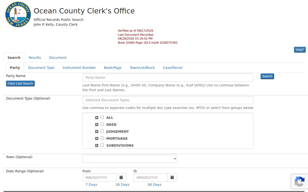
SearchNG results can display document type, instrument number, recording date, book or page, consideration, map and parcel fields, party roles, notes and linked documents. A Toms River instrument should be compared with the same Toms River parcel. Some images are restricted, and image, print, cart, login or copy rules can differ from the free index. The Clerk's records page says people may use the computer index and call for an image or obtain a hard copy, which is the practical fallback when a screen result stops short.
Note: The Toms River online-index date begins April 1, 1977 and does not guarantee unrestricted images for every documented instrument.
Toms River Street Records Compared
Each Toms River street source answers a different question. A Toms River address can have a separate map, tax and legal identity. Parcel systems identify a location and often an owner. Recorded instruments place parties into a dated transfer chain. Permit files add a work or case date. Older reverse directories can put a name at an address in a particular edition. Reading the Toms River sources as a chain keeps a current ownership clue from being mistaken for a current resident list.
| Address-keyed source | What it can show | Access and limit |
|---|---|---|
| Toms River GIS | Parcel, attributes, block and lot, tax-map link, nearby geometry and enabled layers | Public locator; no legal-description guarantee. |
| County GIS | Parcel or ModIV, zoning, flood, wetlands, roads and planning layers | Public Toms River viewer and downloads; data vintage matters. |
| Assessor or property card | Owner, situs, mailing address, values, deductions and description | Toms River office and online references; complete public card view was not captured. |
| County tax list | Municipality, block, lot, qualification, class and location | Online parcel search and Board or municipal-collector follow-up. |
| County deed index | Recorded parties, instruments, dates and legal-description links | Free index from 1977; images and copies have controls. |
| SDL permit or violation | Work, inspection, violation dates, address and applicant evidence | Dynamic account portal; fields and coverage were not captured. |
| Voter status or requested list | Registration context or lawful request output | No verified public street browser; use and privacy limits apply. |
| OCL or OCHS directories | Historic address, phone, occupation or occupancy clues | Historical collections with edition gaps and onsite research. |
Use the parcel ID, block and lot, and the legal description to tie these Toms River records together. A Toms River street name alone is too broad when streets cross ZIP labels, changed names, or have nearby parcels with similar numbering.
Former Toms River Street Names
Toms River has a built-in street-search trap. The township changed from Dover to Toms River in 2006, and a 1973 street-name ordinance changed names used in older material. Search the historical jurisdiction as Dover or Dover Township as well as Toms River Township. Then try the former street name with the present one before deciding that an older deed, directory line, permit, or map is missing.
The ordinance gives useful pairs for a Toms River street search: Dover Avenue became Division Street, First Street became Canoe Street, Dover Street became Rosewood Drive, Orchard Avenue became Hatch Street, and Connecticut Avenue became Raider Way. Other listed changes include Anchorage Drive to South Shore Drive and Cove Road to Reef Drive. The research did not locate a full effective-date table or a township-wide renumbering project, so a renamed-street match should be confirmed with the parcel's legal description or block and lot.
This local quirk also explains why one address trail can move between postal labels, street-list terminology and historic Dover wording. Preserve the original wording in notes instead of silently converting every older record to a current label.
Note: Search current and former street names with Dover, Dover Township, Toms River Township, block and lot, and surname variants.
Toms River Street Permit Clues
Toms River directs address-based permits, inspections and violations to SDL. Those Toms River files can add a useful date layer to a street record. When an existing file is available, keep the Toms River address, permit or case number, applicant or owner role, issue, opening or closing date, project or violation description, inspection status and any stated redaction together. An applicant is an evidence lead, not automatic proof of ownership or occupancy.
The public SDL search fields, result fields, fee and coverage start were not exposed during the research. The documented fallback is a targeted request for a specific Toms River address file. Under the New Jersey Open Public Records Act, ask for an existing permit or case record by address, date, number or other known identifier. Do not ask a custodian to create an open-ended list about people associated with a Toms River street.
Toms River Street Voter Boundaries
Voter evidence has a smaller role in a Toms River street search. New Jersey's Am I Registered? route can confirm registration context, but the research did not verify a public display for all voters on a Toms River street. A full Toms River list follows the county request channel and state disclosure rules. It is not the same thing as a map of everyone living at a Toms River address.
Signatures, protected addresses and sensitive identifiers have separate protections. Toms River property records also leave out many non-owner occupants. Treat a registration result as one dated, limited record and use a lawful request only when it has a clear purpose. The Toms River street list and road map are better for number ranges, ZIPs, wards, districts, school and fire fields than for identifying residents.
Terms for Toms River Street Records
Street research becomes easier once the Toms River record terms stay in their proper lanes. The Toms River assessor, GIS viewer and County Clerk use different identifiers for the same area. These short definitions keep a Toms River search from mixing a parcel location with a legal record or an address directory. They also make a Toms River map result easier to compare with a deed result.
- Parcel
- A mapped property unit. GIS attributes, a parcel ID and tax-map details help locate it, but a map is not a legal survey.
- Situs address
- The physical location of the parcel. It can differ from the owner's mailing address, where tax correspondence goes.
- Plat
- A subdivision or map record that helps connect an address with its block, lot, map number or legal-description context.
- Criss-cross directory
- A reverse-style directory arranged from an address or street toward names and household clues in a specific historical edition.
Block, lot and qualification are the durable Toms River crosswalk when a street label changes. A deed's legal-description line can carry that identity even when it does not repeat the modern street number.
Note: Toms River map and Clerk fields can describe the same parcel while carrying different dates, purposes, and accuracy limits.
Toms River Street Directory History
Modern Toms River parcels need an older companion when the aim is to place a name at a former Toms River address. The Ocean County Historical Society has verified phone-directory runs for 1956-57, 1970-2007, 2010 and 2014. Ocean County Library's catalog also lists 33 Toms River city-directory subject items and 12 microform items, but the exact run of volumes is not published as a complete list. Ask staff to bring the relevant Toms River phone, city, reverse or cross-reference volume, then read the Toms River street section and compare the next available edition.
An old Toms River address entry may use initials, spouse notation, an occupation, a business, an owner or occupant mark, or abbreviations. It is historic evidence, not a claim about the current household. The collections, access routes and how to read them are treated more fully on the Toms River city directory page.
Before the Toms River online deed index begins, the County Clerk office, microfilm, State Archives, library catalog holdings and OCHS materials are the documented fallback chain. The Clerk can help with its computer index, images or hard copies, but the research did not locate exact pre-1977 online-image mechanics.
Note: Toms River historical directory years require staff confirmation because the online catalog does not present a complete sequence of editions.
Date Each Toms River Street Record
A reliable Toms River street result is dated and labeled before it is compared with the next source. Copy the Toms River source, access date, street spelling, municipality wording, parcel identity and the role attached to a name. In SearchNG, record whether a party is direct or indirect and note document type, instrument number, recording date, book or page and any correction or replacement. In Toms River GIS or tax material, distinguish the map-data date from the property or tax context.
For older Toms River material, preserve the edition year and the address as printed. A Toms River phone directory from a known run, a tax map, or a deed can each be true for its own date yet describe different people or conditions. Compare the Toms River legal description and block or lot before treating a former street number as the same parcel. This dates-first Toms River habit is especially important where the official index begins in 1977 and Toms River historical material may use Dover terminology.
Toms River Street Directory Limits
Street directory results cannot show a full Toms River household. An owner on a Toms River property card may receive mail elsewhere, and a Toms River deed party may be a trustee, estate representative, entity or prior owner. Non-owner occupants do not necessarily appear in Toms River parcel records. Utility, delivery and motor-vehicle address records are not public Toms River resident directories. GIS attributes also carry a disclaimer and cannot settle a boundary or legal-description question.
Some Toms River public datasets can redact covered officials under Daniel's Law, and qualifying people can use the New Jersey Address Confidentiality Program. A blank field, a redaction, or a mismatch between a Toms River mailing address and situs should not be treated as an error that needs to be defeated. It may be a lawful privacy limit.
Lawful use. Toms River address records are for personal, lawful research and careful civic or family-history work. Do not use a Toms River address trail to stalk, harass, intimidate, or harm anyone.