
Toms River Neighbors by Block
Public records around a Toms River block answer narrow questions. The GIS and tax layers identify parcels, their block and lot numbers, and other public map attributes. The deed index records transfer parties and legal descriptions. Voter administration has its own controlled request path, while community groups may describe events or membership rules without publishing a roster. The owner on a parcel record can be different from the person who receives mail there, and neither field proves every person at the address.
| Source | What It Shows About a Block | Access |
|---|---|---|
| Toms River GIS | Parcel geometry, feature attributes, block and lot, tax-map links, and enabled map layers | Public address or block-and-lot search; map is not a legal description. |
| Ocean County GIS | Parcel and ModIV data, roads, zoning, flood, wetlands, easements, and planning context | Public data and ArcGIS resources; note the data vintage. |
| Tax list and assessor | Municipality, block, lot, qualification, class, location, and tax context | Parcel and location oriented; complete card fields are not exposed online. |
| Ocean County Clerk | Deed parties, transfer dates, legal lines, and linked recorded instruments | SearchNG index begins April 1, 1977; image and copy controls vary. |
| Voter records | Status context or a lawfully requested list | Election Board and OPRA path; no verified public block browser. |
| Community organizations | Public events, zones, bylaws, civic contacts, and membership rules | Use public contact channels; no roster should be assumed public. |
Toms River neighbors often share a road but not a record identity. A common driveway, easement, merged parcel, or split legal description can make the map look simpler than the deed chain. Record the situs address, block and lot, parcel ID if shown, and source date before comparing adjacent parcels.
Map Toms River Neighbor Parcels
The documented Toms River method is a parcel-adjacency workflow, not a radius or buffer search. Start at the target address in the township GIS, click its feature, then pan and zoom to the parcels that touch it. The public documentation supports address or block-and-lot searching, feature attributes, and map navigation. It does not document a dedicated “neighbors” button, measure tool, or buffer tool. Treat the resulting view as a locator for parcel neighbors, not a claimed list of people.
- Search the Toms River address or known block and lot, then click the target parcel and preserve its displayed attributes and tax-map link.
- Zoom out one or two levels, pan along both sides of the street, and click adjoining parcel polygons. Check rear or side boundaries only when the visible geometry supports that comparison.
- For each Toms River parcel, note the situs, block and lot, parcel ID when displayed, property class, and only the relevant zoning, flood, easement, or right-of-way layer.
- Use block and lot or a legal-description line in SearchNG to compare deed parties, dates, and linked records for the particular parcel.
- Stop before turning parcel facts into a list of people. A public owner field is not a complete household record.
For a complete named-street record chain, use the Toms River streets resource; the block workflow stays focused on immediately adjoining parcels.
Toms River GIS Layer Checks
Turn on only the layers that explain the Toms River block. Parcel or cadastral data helps identify the lot. Road and municipal-boundary layers help orient a street segment. Zoning, flood, wetlands, easement, right-of-way, subdivision, and planning layers can explain why an edge looks irregular or why a neighboring parcel has a different legal context. They do not identify people, establish a survey boundary, or replace a legal description.
| Toms River GIS Element | Documented Use |
|---|---|
| Property location or address | Locates an address; exact matching behavior was not stated. |
| Block and lot | Locates a parcel by tax identity. |
| Feature click | Returns attributes and may show a tax-map download link. |
| Zoom, zoom-out, and pan | Moves from one parcel to a street segment and adjoining polygons. |
| Layer controls | Turns on parcel and other municipal layers; some require a close zoom or full extent. |
| Disclaimer | Supports parcel location and inventory, not a legal description or accuracy guarantee. |
The New Jersey parcel composite is another public map resource used for adjacent-parcel research.
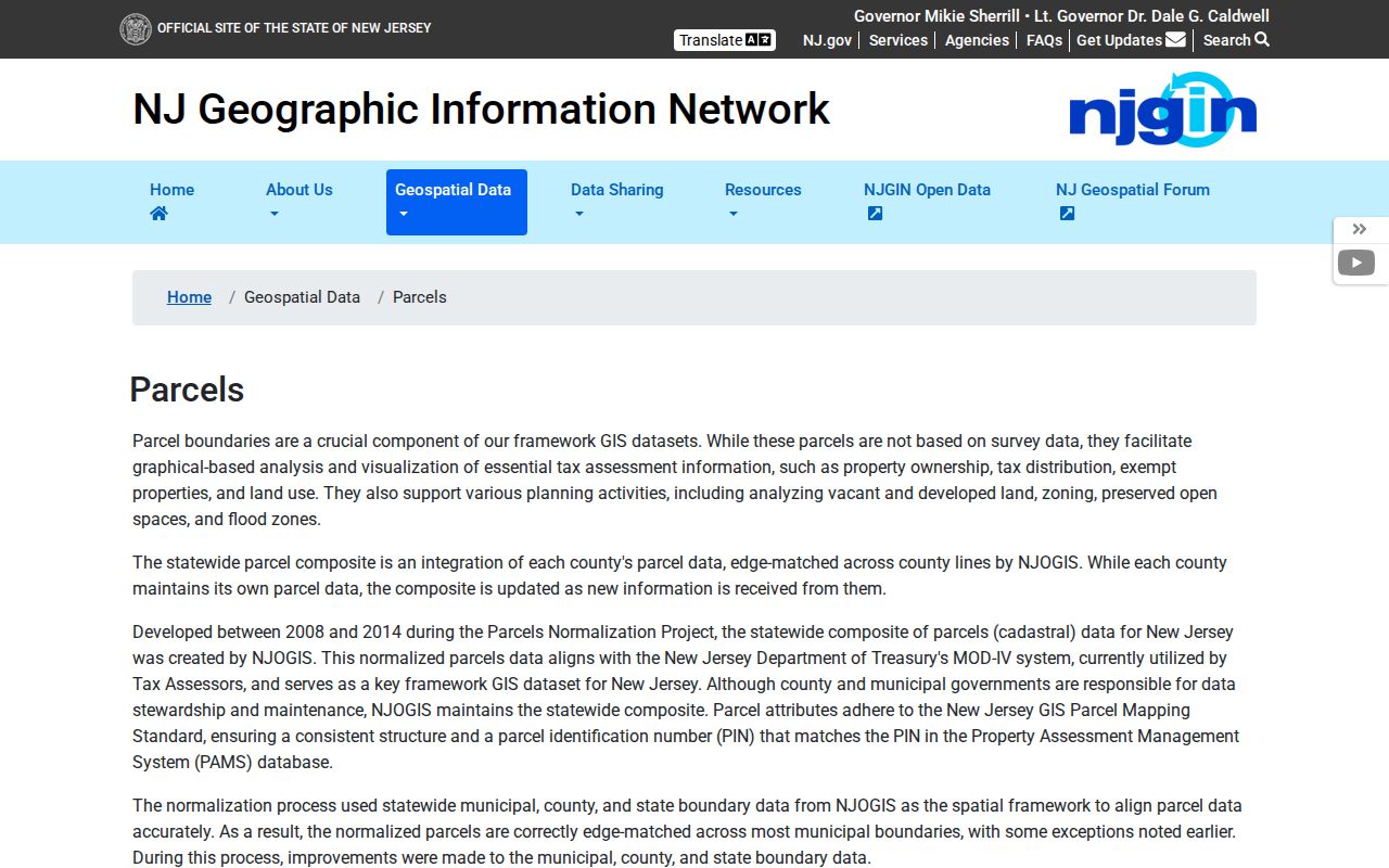
The state composite can search by address, county, municipality, block, and lot, but county parcels may not be edge-matched and Daniel's Law redactions can remove owner names.
Note: A Toms River parcel map locates public records, but a survey or deed controls the legal boundary question.
Toms River Neighboring Deed Roles
The County Clerk index adds a dated transfer layer to a Toms River block map. Search a neighboring parcel by lot and block, map number, parcel ID, legal-description line, or a party name when that connection is appropriate. Capture the instrument number, recording date, document type, book and page, consideration, municipality, legal lines, and linked documents. SearchNG can connect recorded transfers, but it does not prove present occupancy.
Read the party role before using a name as a block fact. A Toms River deed may name a grantor, grantee, trustee, entity, executor, or attorney. Nearby lots may have one owner, shared access, or a legal description that changed after a split or merger. This keeps a neighboring owner from being mistaken for other Toms River neighbors. Search both current and former street names when an older Toms River record does not surface under the modern address.
Note: The same owner can appear on several parcels, so each lot still needs a separate record check.
Toms River Voter Block Limits
New Jersey allows voter-list access through election law and the county request process, but the research did not find a verified public display of every voter on a Toms River block. The state status endpoint returned a 403 during inspection, so its live field labels and output should not be guessed. A registration status tool is not a street browser and cannot establish which Toms River neighbors currently live on a block. Signatures, protected addresses, driver-ID information, and other sensitive identifiers do not belong in block notes.
For an identifiable Toms River government record, the Ocean County Election Board information-request channel directs requesters to its OPRA procedure. Name the record, election or date span, and preferred format. Election statutes restrict misuse, and a returned-mail or inactive status is not proof that a person never lived at the address.
Toms River Community Contacts
Community organizations give a Toms River block social context without providing a household roster. Use their public contact points to learn about meetings, zones, events, bylaws, or civic work. Do not seek membership lists that have not been publicly released. The records below identify the actual public-facing organization details found in local research.
Green Island Community Association
Green Island's membership page describes property-owner and associate categories, membership verification, meetings, voting, events, and access rules. It lists 100 Green Island Road, Toms River, NJ 08753, and gicanjmembership@gmail.com. No public member roster was located.
Holiday City Organization
Holiday City lists 1846 Yorktown Boulevard, Toms River, NJ 08753, with 732-255-2221 and 732-255-0029. Public materials include newsletters, bylaws, maps and zones, dues, clubs, events, and an action form. A complete member directory was not located.
Toms River Civic Bodies
The Boards and Commissions listing identifies public bodies such as the Board of Health, Green Team, Historic Preservation, Planning, and Zoning. Meeting information can show civic activity, not every neighbor on a block.
Note: Community directories describe public participation and contacts, not a complete list of residents for any Toms River area.
Civic Context for Toms River
The Greater Toms River Chamber directory has category, ZIP, and search controls for civic and business contacts. It showed 50 of 424 results during the inspection, which is useful for a public organization search but not for identifying Toms River neighbors. Toms River Rotary also provides public community-service and scholarship context, while the local library and historical society can help with older neighborhood ties, maps, phone books, and family materials.
The Toms River Boards and Commissions page provides the public civic-reference screen shown here.
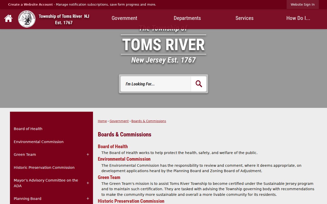
Public board names, agendas, and minutes can document a civic role, but they cannot confirm an address or a private association membership.
Toms River Maps and Deeds
Map layers and deed records serve different functions. This distinction is a Toms River comparison worth keeping in every block note: GIS identifies and inventories parcels, while a recorded instrument supports a transfer or legal-description trail. A parcel edge, tax-map link, or zoning layer can help select the right lot. It cannot replace the grantor, grantee, date, or legal lines in a recorded document.
For a Toms River historical address, the 1973 street-name ordinance can also matter. Examples include Dover Avenue becoming Division Street and First Street becoming Canoe Street. Use both forms with the block and lot when a modern name does not find the older parcel record.
Toms River Neighbor Tool Comparison
Official sources and commercial neighbor tools are not interchangeable. Commercial categories commonly combine old address, marketing, brokered, or user-supplied material. They can be stale, merge similar names, or point to a former address. A Toms River parcel decision is better grounded in a dated government record and the office that keeps it.
| Official Toms River Record | Commercial Neighbor Tool Category | How to Treat It |
|---|---|---|
| GIS parcel and tax context | Compiled address or marketing history | Use the GIS to locate a lot; do not infer every person at an address. |
| Recorded deed and Clerk index | Combined ownership and name profile | Check document date, party role, and legal description with the custodian. |
| Election Board request path | Broad block list claim | Follow statutory restrictions and do not publish protected identifiers. |
A correction belongs with the agency or organization that holds the record. Suppressing a commercial listing does not amend a Toms River deed, parcel file, voter record, or civic directory.
Toms River Neighbor Privacy
Several kinds of Toms River block information remain private or restricted. Parcel records do not list every household member. Utility, delivery, and customer data are not public neighborhood sources. Some Toms River neighbors may have protected records. The Address Confidentiality Program gives qualifying people a substitute address for official use, and Daniel's Law can shield covered persons' home address and unpublished phone number on government websites. Do not reconstruct a protected address from adjacent parcels, old lists, or map layers.
The New Jersey Address Confidentiality Program and the Office of Information Privacy describe those protections. Correct a public-record error with the Toms River custodian or other agency that keeps it. A public record is not permission for repeated unwanted contact, threats, surveillance, harassment, or intimidation.
Lawful use. Use Toms River neighbor records for personal, lawful block research. Do not use parcel or civic information to stalk, harass, intimidate, or harm another person.